
Places for birds in Kuwait
A conservationist once remarked that a bird is 5% bones, blood and feathers; the other 95% is place! So identifying the places that are important for birds is critical for birders but also for nature conservation. And birders often become ardent conservationists because they learn to appreciate the habitats required for the survival of birds. Despite the small size of the State of Kuwait, there are many places to find interesting habitats for birds. This brief guide provides a selection of the most important places to observe birds in Kuwait, but it cannot do justice to the variety of distinct areas and habitats that exist. Sometimes even parks and gardens, lone strands of trees, a water-collection point, a pond or desert rock outcrop can support fascinating birds. Although this guide gives some information about sites of interest where birds can be found, it is by no means a comprehensive list.
| Photo Main | ||
|---|---|---|
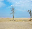
| Abdalliyah Preserve |
") |
Located in Abdalliyah Kuwait Oil Company Field south of Kuwait City, this is a private protected-area which has been carefully restored and landscaped. |
| Abdaly Farms |
") |
A large area of agricultural farms lying to the East of Road 80 to Basra (Iraq) close to the northern border of Kuwait. Access is by private car, driving on dirt-roads through private farmland and orchards. |
| Ahmadi Town |
An "oil town" south of Kuwait City, it has been famous for its gardens and park; an attractive area to search for birds. Obviously, birds are often on private land. The gardens around private houses require permission to be entered, but much is visible from the numerous roads. |
|
| Al-Abraq Al-Khabari |
") |
An isolated small oasis farm in the western desert of Kuwait with access by private agreement with the owner. It is one of the most interesting areas for rare migrant birds in the country. |
| Al-Batin Park |
 |
An internally draining wadi forming the north-western border with Iraq. The area is part of a flat, desert plateau of hard-packed gravelly sand with numerous playas, at 240 m. |
| Al-Doha Nature Reserve |
") |
A sandy coastal sabkhah, some of which is flooded by exceptional tides, with salt-tolerant vegetation; and associated intertidal mudflats. Drainage water from a few nearby private chalets or an Entertainment Park flows across part of the site and supports 0.5 ha of Phragmites reedbed. |
| Auhah Island |
This is a very small uninhabited Island 16 km South East of Falaika which has a lighthouse and small heliport. |
|
| Bubiyan Island |
") |
Kuwait owns an important part of the Mesopotamian Delta – an ecosystem of vast flat muddy islands and river-like tidal channels, in the northeast corner of the country sandwiched between Kuwait’s mainland, Iraq and Iran. Bubiyan is a remarkable deltaic island covering an area of 863 km2. |
| Dawhat Kazima |
 |
A shallow, relatively well-sheltered bay, part of the larger Kuwait Bay system, with extensive intertidal mudflats (c.890 ha). The site is important for economically valuable shrimp nurseries, and supports both recreational and traditional fishing with fixed traps (hadra). |
| Doha Peninsula |
An area of harbours, mudflats and sabkhas to the west of Kuwait City reached by following the 7 Ring Road and then access to the peninsula is via the Doha Road next to Entertainment City |
|
| Fahaheel Park |
 |
The town of Fahaheel is south of Kuwait City and has a public Park and a shoreline across the road. Access is open and there are a few fast food outlets inside the Park. The Park is grassed with some mature trees and shrubs, but very popular with the general public on weekends. |
| Failaka Island |
") |
A medium-sized island, 20km north-east of Kuwait City that is largely deserted. Failaka has quite a different ecosystem to mainland Kuwait, and its budding flowers and changing temperatures are much appreciated by locals. |
| Green Island |
") |
An artificial island (actually a peninsula) with mature habitat in the form of trees and shrubs with an inland beach on the eastern side and tidal gates on the north and southern end. |
| Jahra East Outfall (JEO) |
") |
The most Easterly sewage and drainage outfall from the Jahra Area near Judailyat with extensive reed beds, grassy marsh area on the coastline and degraded sabkhas further inland. |
| Jahra Farm |
") |
An area of traditional commercial and subsistence farms situated in the centre of Jahra City and is fed by from an oasis that is now being pumped. Ali’s farm has a small pond that is used to hold water for watering the crops. |
| Jahra Pools Reserve (JPR) |
") |
A fenced Nature Reserve, managed by the Environment Public Authority (EPA), consisting of a sewage outfall with pools surrounded by reed beds and sabkhas. Access is by permit only |
| Jal Az-Zor (inc. SAANR) |
") |
A limestone and sandstone escarpment rising steeply to 116 m from the coastal mudflats and associated saltmarshes and sand dunes on Kuwait Bay. A gravel plain extends northwards from the escarpment ridge and gives rise to the extensive wadi system of Ar-Rimam. |
| Jebel Al-Benayah and Khiran Town |
 |
A low protruding hill (jebel) near Khiran town. Access is from Road 290, south of Road 278. The hill is a rock-climbing and picnic site, but is a good view point for migratory birds. |
| Kabd |
A large, fenced and ungrazed area south of Sulaibiya off the Kabd Road. Access is by permit from the Kuwait Institute of Scientific Research (KISR). |
|
| Kubbar Island |
 |
A small sandy island off the south of Kuwait. Access is open to all, but visitors should respect and avoid disturbing the breeding Tern colonies in the summer months. Kubbar is historically famous for it’s colonies of breeding sea birds. One of a small group of coral islets and associated reefs. |
| Kuwait City |
 |
|
| Liyah Protected Area |
 |
A large fenced area split into North and South by Iron Horse Road, to the west of Highway 80. The desert habitat is slowly regenerating, but some indigenous plants and trees have also been planted to provide suitable habitat for the biodiversity in this protected area. |
| Miskan Island |
") |
This is a small island to the south of Bubiyan and is devoid of any life other than an lighthouse. It shares similar geology to Failaka with medium to coarse sand in shore with coral reefs present at particular depths. |
| Port Zour |
A fenced oil terminal at Mina Al Zour, on the Arabian Gulf headland of Ras Al Zour is south of Fahaheel. Exit on Road 270 off Highway 40 (Fahaheel Express Way). Habitat includes urban gardens, trees, shrubs and bushes as well as a sand golf course on the site. |
|
| Qaru Island |
") |
The name "Qaru" was derived from the large amounts of petroleum sediments in the areas, known as Qar in Arabic. It is the smallest of the off-shore islands and also the furthest away from Kuwait mainland (approximately 37 km from the southern Kuwaiti coastline). |
| Ratqa |
An area of semi-desert near the Iraq border, just west of the Basra Road (Highway 80). |
|
| Rawdatain |
") |
An oasis with a water collection point and a mature groves of trees around the plant. It is just south of Abdaly and just off the Basra Road (Highway 80). |
| Sabah Al Ahmad Sea City |
 |
Just south of Zour, exit on Road 278 which is lined with Acacia’s for much of the route. This will take you to the newly developed, but still in progress Sea City project with its pristine lagoons and beaches. |
| Shuwaikh Island (also known as Qurain or Akkaz Island) |
This "island" is now joined to Shuwaikh Industrial Area (Free Trade Zone) due to industrial area infilling on the southern part of Kuwait Bay near the Kuwait City industrial area harbour. Before this time, the coast here was an archaeological site with pieces dating back to 2000 BC. |
|
| Sulaibikhat Bay |
A shallow, well-sheltered bay, part of the larger Kuwait Bay system, with extensive intertidal mudflats (c.2,250 ha). Reportedly the most biologically productive marine waters in Kuwait, and an economically valuable shrimp nursery. |
|
| Sulaibiya Pivot Fields |
") |
A large private area of cultivated farmland, predominantly short turf and alfalfa and also a small fenced pool with mature phragmite reedbeds that is strictly private. |
| Umm al Maradim Island |
 |
This island is closest to Qaruh Island and is known to have deep waters surrounding it in which large ships can safely anchor. Another island, further south is Um Al-Maradim, near the latitude of the Saudi border. |
| Umm an Namil Island |
A small island, whose name is derived from ‘Mother of Ants’ and is located within Kuwait Bay and only 600m from the mainland. |
|
| Wafra Farms |
A large area of traditional and private farms on the southern border with Saudi Arabia. Access to any of the farms is by private agreement with the owners. This large area of private, traditional farms is located near the border with Saudi Arabia, in southern Kuwait. |
|
| Warbah Island |
Warbah is predominantly a large mud-flat. The island has no permanent inhabitants although the government maintains a coastguard post, so all access is strictly controlled with the Coastguard. |